Talks & Teaching
Since 2019, I have a teaching position at the University of Würzburg. In addition, I have been teaching at the AniMove Science Schools for several years. Find out about my talks and teaching below.
Blog post about this talk: “Presenting at the Arctic System Science Conference 2026 at AWI, Potsdam”
Abstract: Snow depth is a crucial climate variable in Arctic terrestrial ecosystems. Acting as an insulating layer, snow depth regulates subnivean temperature and active layer thickness, protects vegetation from exposure to harsh conditions, and impacts water and soil nutrient availability during melt. Thereby, it affects vegetation dynamics and influences resource availability for wildlife such as reindeer. Simultaneously, snow depth can constrain forage accessibility for herbivores and increase energetic costs of moving and feeding during winter. However, local ecological effects of snow remain poorly understood, largely due to lack of snow depth data at ecologically relevant spatio-temporal scales. In this study, we investigate the potential of spatially continuous UAV-derived snow depth data for analysing snow-ecosystem interactions on Svalbard. We use a fixed-wing, LiDAR-enabled Uncrewed Aerial Vehicle (UAV) to derive snow depth as the difference between surface elevations recorded under snow-covered and snow-free conditions. Employing Real Time/Post Processing Kinematics (RTK/PPK), we achieve a spatial resolution of 2.5 cm for 216.5 ha at cm-scale positional accuracy. Extensive in situ validation temporally synchronous to UAV acquisitions shows high UAV-derived snow depth estimation accuracy (R²=0.93. n=340). Using semi-variogram and autocorrelation function thresholding, we analyse spatial scales of snow depth variation, quantifying folding frequencies at or below 2.5 metres. Additionally, we find that UAV-derived snow depth shows no spatially stable correlation with standard proxies conventionally used in Arctic ecology research when spatially continuous snow data are unavailable. Our findings suggest that UAV-derived snow depth data at cm scale have high potential to improve the understanding of snow depth impacts on Arctic ecosystem dynamics.
Duration: 10 minutes
In this guest lecture, students from Norway and all over Europe who have come to Svalbard to study Arctic winter ecology, were introduced to UAV remote sensing and geo-analysis for ecological research applications in the high Arctic. The guest lecture was held at the invitation of Prof. Dr. Simone Lang (UNIS), together with Prof. Dr. Larissa Beumer (UNIS), as part of a six-week international MSc. course on Arctic winter ecology. The course segment focused on two applications: On the one hand, students learned how to model the spatial occurrence of Betula nana using UAV remote sensing and in situ data collected together with the students in the field. Betula nana (dwarf birch) is a deciduous shrub species widely distributed across Arctic and subarctic regions. Due to considerable warming and potential changes in the snow regime over recent years, the course focused on exploring the range of snow depths at which Betula nana can be found to understand to which extent Betula nana may extend its abundance on Svalbard in future. On the other hand, students learned how to model reindeer foraging potential from UAV remote sensing and in situ data collected together with the students within the course, in particular to understand the effect of snow depth on resource accessibility. Snow depth affects food availability for the Svalbard reindeer, as it restricts access to plants and increases energetic costs of movement and foraging. Thus, students explored the use of remote sensing to quantify the effect of snow depth on foraging patterns, besides other influencing factors. Overall, the course segment consisted of an introduction day, four field days for UAV remote sensing and in situ data acquisition, and a practical analysis day. In the end, students developed independent group projects on the above-mentioned topics, conducting their own analyses that they then presented as research posters.
Duration: 6 sessions (1 introduction day, 4 field days, 1 analysis day)
This course, taught by a team of EORC lecturers at Umweltforschungsstation Schneefernerhaus (UFS) – the highest research station in Germany located at Zugspitze – introduced students to Earth observation of alpine environments. Core focus of the course was the use of UAV remote sensing (LiDAR, multi-spectral) for cm-resolution mapping of micro-topography and rock/vegetation surface characteristics along elevation gradients. Students were shown how both UAV remote sensing and in situ data are collected under sometimes challenging conditions in the high alps in winter by jointly conducting a real-world field data acquisition campaign. In this context, they learned about how the collected data can be used, e.g for deriving variables such as snow depth and snow cover critical to the understanding of geomorphological and ecosystem processes in the Alps. In addition, students were introduced to research conducted at UFS by different institutions across various scientific fields, showcasing the multi-disciplinary potential of the station.
Duration: 3 sessions (full days, 3-days block)
In this talk, I presented contents of my doctoral studies on the potentials of animal-environment interactions for remote sensing research and the use of movement-tracked animals as geoinformants to an audience composed of members of the Geographic Society of Würzburg (GGW), Geography students studying at University of Würzburg, as well as members of the interested public. The talk was given in the context of the 2025 GGW Doctoral Award ceremony by the Geographical Society of Würzburg, at which I received the GGW 2025 Doctoral Award.
Duration: 10 minutes
In this talk, I explored the potential of large-scale, multi-species animal movement tracking for Earth observation and opportunities in combining remote sensing and ecological data. The talk was given as part of the Geoinformatics Forum at ifgi at the invitation of Prof. Dr. Edzer Pebesma and Johannes Heisig. From the abstract: Land use/land cover (LU/LC) classifiers are models that transform environmental data into interpretable, quantifiable information. Conventional LU/LC classification approaches rely on human-defined classes and human-collected ground truth data to train a classifier. Animals, like humans, perceive, interpret and differentiate their environment, resulting in distinctive movement behavior governed by the animals’ needs and the surrounding conditions. In this study, we utilize the animal’s unique view on the landscape to classify environmental data: We propose a Deep Learning approach that learns cluster-friendly representations from animal-environment interactions, generating behavior-derived ground truth data for animal land use (ALU) classification from environmental data. The classifier’s applicability was measured within 153 areas of interest (AOI) within Europe, covering an area of 53,167.55 km2. Our approach achieved high accuracies in both representation learning (0.881) and ALU classification (0.806), showing that, overall, classes defined by clustered representations of animal-environment interactiond were well-differentiable in the environmental data. With an average ground truth spatial density of one sample per 0.51 km2 every three years, the presented approach exceeded sampling densities of state-of-the-art human labelling campaigns such as the European Land Use/Cover Area frame Survey (LUCAS) with 15 km2 per sample/three years. In comparison to human LU/LC, thematic resolution of ALU varied per land surface type, with higher thematic resolution in natural habitats such as grasslands and lower thematic resolution in urban areas. Our study demonstrates how animals can be employed as environmental informants in remote sensing research by using them as landscape interpreters to generate ground truth for land use classifications.
Duration: 30 minutes
In this talk, I presented work on deriving snow depth data using UAV LiDAR remote sensing on Svalbard to investigate snow-ecosystem interactions at fine spatial scales. The talk was given as part of the SvalbardMonitoring workshop organized by Dr. Hans Tømmervik (NINA) which took place in Longyearbyen, Svalbard, from 20th to 23rd of October 2025. From the abstract: Snow is an essential climate variable crucial to Arctic ecosystem functioning. Its high albedo and seasonal variability drive thermal gradients that globally affect atmospheric temperature. Snow also has strong local impacts: Acting as an insulating layer, snow depth regulates subnivean temperature and active layer thickness, protects vegetation from icing, and impacts water and soil nutrient availability during melt. It thereby affects plant growth dynamics and phenology, influencing resource availability for herbivorous wildlife, such as reindeer. At the same time, snow depth can constrain forage accessibility for herbivores and increase the energetic costs of moving and feeding during winter. However, local ecological effects of snow are still not fully understood, largely owing to a lack of snow depth data at ecologically relevant spatio-temporal scales. Such are challenging to cover adequately through traditional in-situ snow depth measurements. In this study, we investigate the potential of high resolution, spatially continuous UAV-derived snow depth data to advance Arctic ecological research. Using a fixed-wing, LiDAR-enabled Uncrewed Aerial Vehicle (UAV), we derive snow depth as the difference between digital surface models recorded under snow-covered and snow-free conditions, with a spatial resolution of 2.5 cm per pixel, for an area of 216.5 ha across two study sites in high-arctic Svalbard. We validate the model with 340 in-situ snow depth measurements temporally synchronous to UAV acquisitions, showing a high accuracy (R-squared = 0.93). Using a semi-variogram and autocorrelation function thresholding approach, we analyse at which spatial scales snow depth varies to quantify the folding frequency, i.e. the minimum sampling distance to measure snow depth with, at or below 2.5 metres. In addition, we demonstrate that UAV-derived snow depth shows no spatially stable correlation with standard proxies (e.g., terrain ruggedness, hillshade, elevation, distance to coast) conventionally used in Arctic ecology research when spatially continuous snow data are unavailable. Our findings suggest that UAV-derived, spatially continuous snow depth data at sub-decimeter spatial resolutions have a high potential to contribute to a better understanding of the impact of snow depth on Arctic ecosystem dynamics.
Duration: 30 minutes
In this guest lecture, I introduced satellite and UAV remote sensing, geo-analysis and spatial modelling for population ecology research to Arctic Population Ecology BSc. students, together with my colleague Sebastian Buchelt. The guest lecture was held at the invitation of Assoc. Prof. Dr. Larissa Beumer (UNIS) as part of a six-week international BSc. course on Arctic Population Ecology. Students were introduced into UAV (drone) remote sensing and its applicability for detecting, counting and mapping animals to estimate animal populations, such as Svalbard reindeer. Students were presented different sensing and mapping methods, UAV platforms as well as the effects of flight parameters such as flight altitude or flight speed on the quality and resolution of the acquired data. Students learned how UAV remote sensing data can be used to describe the environment for being able to model relationships between animal occurrences and environmental covariates. In addition, they learned how UAV missions are planned, which regulations apply and how collected images are converted into geo-spatial maps (orthomosaics) using photogrammetric methods such as structure-from-motion (SfM). Outside, in the tundra, students were shown hands-on how to use UAVs to map an area of interest using RGB and thermal sensors, as well as how to find, identify and classify reindeer from the air. They also learned how to use differential GNSS to measure positions of objects, making use of Real-Time Kinematics (RTK), and how to use this technology for high-accuracy UAV mapping. Back in the lab, the group was shown how to analyse selection decisions made by reindeer from the acquired environmental data and to model reindeer selection/habitat use. Students learned to work with spatial point and spatial image data and were introduced to spatial statistics, e.g. point pattern analysis for quantifying the distribution of reindeer using methods such as Clark Evan‘s test, Ripley’s reduced second moment function K or kernel density estimations. In addition, students learned how to fit Generalized Linear Models (GLMs) on UAV-derived remote sensing data for modelling selection and predicting habitat use. In the end, the students were able to fit their own selection models and to therefrom create maps that showed areas of higher and lower selection probability within the experiment area.
Duration: 3 sessions (full days, 3-days block)
In this guest lecture, my colleague Sebastian Buchelt and myself taught UAV (drone) remote sensing of the cryosphere to remote sensning MSc. students. The guest lecture was held at the invitation of Assoc. Prof. Dr. Eero Rinne (UNIS) as part of a multi-week international MSc. course on Remote Sensing of the Cryosphere. The course combined classroom sessions on flight regulations, data georeferencing and processing, and platform and sensor types with practical training in mission preparation and planning. On the second day, students were taught how to acquire high-resolution UAV imagery at the Longyearbreen, a glacier nearby Longyearbyen, to study surface temperature variations, melt channel features, and snow cover. On the third day, students processed the acquired data into orthomosaics and digital elevation models (DEMs), gaining first-hand experience with the challenges of handling large UAV datasets. The exercise demonstrated how UAV-derived spectral and thermal data can be applied to improve our understanding of cryospheric processes.
Duration: 3 sessions (full days, 3-days block)
This course introduces UAV/UAS (drone) remote sensing and field methods to ecologists. They get to know field campaigning (sampling methods, routing, positioning etc.), in-situ data sampling (parameters, field devices such as spectrometers, soil moisture probes etc.) and UAS (drone) imagery acquisition (platforms, sensors, flight planning, licensing, training). The course prepares them for a field day at a research site where data are collected under real-world research conditions. Afterwards, they learn to handle, process and analyse the recorded data and turn them into interpretable information. During the course, students create a personal guide book that they can use later in their careers to successfully conduct UAV research.
Duration: 10 sessions (full days, 2-weeks block)
This methodological course introduces Deep Learning with a practical focus on how to use it for image processing in Earth observation. Students get to know the principles behind the design of Neural Networks and the training thereof using Deep Learning. They learn about loss, backpropagation, optimization, activation functions & vanishing gradients, over- & underfitting, regularization, augmentation, convolutions, layers of state vs. stateless layers, sequential and non-sequential network designs for image processing tasks such as classification and segmentation etc. The course is taught
Duration: 12 sessions (1.5 hours each)
This modelling course introduces concepts and methods to Earth observation students who want to learn to work with animal movement trajectories, a special type of spatio-temporal data, and integrate such with Earth observation analyses. The course aims to find data-driven answers to questions such as: Why do animals move through the landscape the way they do? How are they impacted by their environments? And: Which environmental conditions are tied to what kind of of movement behavior? While the course introduces background knowledge on topics such as movement theory, the effects of discretely observing continuous processes (e.g. sampling rate, autocorrelation, bias etc.), scale-dependencies/matching, tracking approaches and location error, its practical focus lays on methods to handle and analyze tracking data (e.g. using geometric & variance component analyses, behavioral segmentation, area-metrics such as home ranges, remote-sensing driven trajectory analysis incl. corridor analysis & habitat analysis) as well as tracking data in combination with remotely sensed environmental data (e.g. through resource utilization modelling, resource selection modelling and step selection modelling). This leads students to eventually be able to independently spot patterns in movement data, make connections to environmental conditions, and, finally, jointly model movement tracking and remotely sensed environmental data.
Duration: 4 sessions (4 hours each)
In this course, ecology students are introduced to remote sensing and geo-analysis for ecological research applications and learn to independently use remote sensing in their own research fields. In the first week, students are introduced to remote sensing and geo-spatial data and methods and learn to use
Duration: 10 sessions (full days, 2-weeks block)
In this guest lecture, Arctic winter ecology MSc. students were introduced to satellite and UAV remote sensing and geo-analysis for ecological research applications in the Arctic. The guest lecture was held at the invitation of Assoc.Prof. Dr. Simone Lang (UNIS) as part of a six-week international MSc. course on Arctic winter ecology. On the first day, students were introduced to remote sensing research applications, physical principles of remote sensing and fundamental methods for remote sensing data analysis. In an hands-on session, they learned to handle, visualize and analyze remote sensing data from both Earth observation satellites and Unoccupied Aerial Vehicles (UAVs) using geo-spatial software, including QGIS and
Duration: 2 sessions (full days, 2-days block)
Interactive visualizations using
Duration: 3 sessions (1.5 hours each)
This methodological course introduces Deep Learning with a practical focus on how to use it for image processing in Earth observation. Students get to know the principles behind the design of Neural Networks and the training thereof using Deep Learning. They learn about loss, backpropagation, optimization, activation functions & vanishing gradients, over- & underfitting, regularization, augmentation, convolutions, layers of state vs. stateless layers, sequential and non-sequential network designs for image processing tasks such as classification and segmentation etc. The course is taught
Duration: 12 sessions (1.5 hours each)
Remote sensing applications; physical principles (electromagnetic radiation, absorption, emission, reflectance, optics, spectral information); spatial raster & vector data types; coordinate reference systems & projections; QGIS &
Duration: 10 sessions (full days, 2-weeks block)
This modelling course introduces concepts and methods to Earth observation students who want to learn to work with animal movement trajectories, a special type of spatio-temporal data, and integrate such with Earth observation analyses. The course aims to find data-driven answers to questions such as: Why do animals move through the landscape the way they do? How are they impacted by their environments? And: Which environmental conditions are tied to what kind of of movement behavior? While the course introduces background knowledge on topics such as movement theory, the effects of discretely observing continuous processes (e.g. sampling rate, autocorrelation, bias etc.), scale-dependencies/matching, tracking approaches and location error, its practical focus lays on methods to handle and analyze tracking data (e.g. using geometric & variance component analyses, behavioral segmentation, area-metrics such as home ranges, remote-sensing driven trajectory analysis incl. corridor analysis & habitat analysis) as well as tracking data in combination with remotely sensed environmental data (e.g. through resource utilization modelling, resource selection modelling and step selection modelling). This leads students to eventually be able to independently spot patterns in movement data, make connections to environmental conditions, and, finally, jointly model movement tracking and remotely sensed environmental data.
Duration: 5 sessions (full days, 1-week block)
Basics of
Duration: 12 sessions (1.5 hours each)
A practical guide towards building custom GEE processing pipelines natively in
Duration: 1 session (1.5 hours)
This methodological course introduces Deep Learning with a practical focus on how to use it for image processing in Earth observation. Students get to know the principles behind the design of Neural Networks and the training thereof using Deep Learning. They learn about loss, backpropagation, optimization, activation functions & vanishing gradients, over- & underfitting, regularization, augmentation, convolutions, layers of state vs. stateless layers, sequential and non-sequential network designs for image processing tasks such as classification and segmentation etc. The course is taught in
Duration: 12 sessions (1.5 hours each)
This course introduces remote sensing field methods to ecologists. They are get to know field campaigning (sampling methods, routing, positioning etc.), in-situ data sampling (parameters, field devices such as spectrometers, soil moisture probes etc.) and UAS (drone) imagery acquisition (platforms, sensors, flight planning, licensing, training). This prepares them for a field day at a research site where data are collected under real-world research conditions. Afterwards, they learn to handle, process and analyse the recorded data and turn them into interpretable information.
Duration: 10 sessions (full days, 2-weeks block)
This modelling course introduces concepts and methods to Earth observation students who want to learn to work with animal movement trajectories, a special type of spatio-temporal data, and integrate such with Earth observation analyses. The course aims to find data-driven answers to questions such as: Why do animals move through the landscape the way they do? How are they impacted by their environments? And: Which environmental conditions are tied to what kind of of movement behavior? While the course introduces background knowledge on topics such as movement theory, the effects of discretely observing continuous processes (e.g. sampling rate, autocorrelation, bias etc.), scale-dependencies/matching, tracking approaches and location error, its practical focus lays on methods to handle and analyze tracking data (e.g. using geometric & variance component analyses, behavioral segmentation, area-metrics such as home ranges, remote-sensing driven trajectory analysis incl. corridor analysis & habitat analysis) as well as tracking data in combination with remotely sensed environmental data (e.g. through resource utilization modelling, resource selection modelling and step selection modelling). This leads students to eventually be able to independently spot patterns in movement data, make connections to environmental conditions, and, finally, jointly model movement tracking and remotely sensed environmental data.
Duration: 5 sessions (full days, 1-week block)
Remote sensing applications; physical principles (electromagnetic radiation, absorption, emission, reflectance, optics, spectral information); spatial raster & vector data types; coordinate reference systems & projections; QGIS &
Duration: 10 sessions (full days, 2-weeks block)
Basics of
Duration: 12 sessions (1.5 hours each)
Remote sensing of forests, vulnerabilities & risks, biodiversity, wildlife ecology, natural resources, fire & burnt areas, coasts, diseases & health, agriculture, soil, land cover & land use, human settlements, policy etc.
Duration: 12 sessions (1.5 hours each)
Duration: 1 session (2.5 hours)
Duration: 2 sessions (full days)
This course introduces remote sensing field methods to ecologists. They are get to know field campaigning (sampling methods, routing, positioning etc.), in-situ data sampling (parameters, field devices such as spectrometers, soil moisture probes etc.) and UAS (drone) imagery acquisition (platforms, sensors, flight planning, licensing, training). This prepares them for a field day at a research site where data are collected under real-world research conditions. Afterwards, they learn to handle, process and analyse the recorded data and turn them into interpretable information.
Duration: 10 sessions (full days, 2-week block)
This methodological course introduces Deep Learning with a practical focus on how to use it for image processing in Earth observation. Students get to know the principles behind the design of Neural Networks and the training thereof using Deep Learning. They learn about loss, backpropagation, optimization, activation functions & vanishing gradients, over- & underfitting, regularization, augmentation, convolutions, layers of state vs. stateless layers, sequential and non-sequential network designs for image processing tasks such as classification and segmentation etc. The course is taught in
Duration: 12 sessions (1.5 hours each)
(Interactive) visualizations using
Duration: 5 sessions (1.5 hours each)
This modelling course introduces concepts and methods to Earth observation students who want to learn to work with animal movement trajectories, a special type of spatio-temporal data, and integrate such with Earth observation analyses. The course aims to find data-driven answers to questions such as: Why do animals move through the landscape the way they do? How are they impacted by their environments? And: Which environmental conditions are tied to what kind of of movement behavior? While the course introduces background knowledge on topics such as movement theory, the effects of discretely observing continuous processes (e.g. sampling rate, autocorrelation, bias etc.), scale-dependencies/matching, tracking approaches and location error, its practical focus lays on methods to handle and analyze tracking data (e.g. using geometric & variance component analyses, behavioral segmentation, area-metrics such as home ranges, remote-sensing driven trajectory analysis incl. corridor analysis & habitat analysis) as well as tracking data in combination with remotely sensed environmental data (e.g. through resource utilization modelling, resource selection modelling and step selection modelling). This leads students to eventually be able to independently spot patterns in movement data, make connections to environmental conditions, and, finally, jointly model movement tracking and remotely sensed environmental data.
Duration: 5 sessions (full days, 1-week block)
Remote sensing applications; physical principles (electromagnetic radiation, absorption, emission, reflectance, optics, spectral information); spatial raster & vector data types; coordinate reference systems & projections; QGIS &
Duration: 10 sessions (full days, 2-weeks block)
Basics of
Duration: 12 sessions (1.5 hours each)
Remote sensing of forests, vulnerabilities & risks, biodiversity, wildlife ecology, natural resources, fire & burnt areas, coasts, diseases & health, agriculture, soil, land cover & land use, human settlements, policy etc.
Duration: 12 sessions (1.5 hours each)
This methodological course introduces Deep Learning with a practical focus on how to use it for image processing in Earth observation. Students get to know the principles behind the design of Neural Networks and the training thereof using Deep Learning. They learn about loss, backpropagation, optimization, activation functions & vanishing gradients, over- & underfitting, regularization, augmentation, convolutions, layers of state vs. stateless layers, sequential and non-sequential network designs for image processing tasks such as classification and segmentation etc. The course is taught in
Duration: 12 sessions (1.5 hours each)
Spectrometric field sampling, hyperspectral image processing, spectral unmixing in
Duration: 2 sessions (full days, 2-days block)
(Interactive) visualizations using
Duration: 5 sessions (1.5 hours each)
This modelling course introduces concepts and methods to Earth observation students who want to learn to work with animal movement trajectories, a special type of spatio-temporal data, and integrate such with Earth observation analyses. The course aims to find data-driven answers to questions such as: Why do animals move through the landscape the way they do? How are they impacted by their environments? And: Which environmental conditions are tied to what kind of of movement behavior? While the course introduces background knowledge on topics such as movement theory, the effects of discretely observing continuous processes (e.g. sampling rate, autocorrelation, bias etc.), scale-dependencies/matching, tracking approaches and location error, its practical focus lays on methods to handle and analyze tracking data (e.g. using geometric & variance component analyses, behavioral segmentation, area-metrics such as home ranges, remote-sensing driven trajectory analysis incl. corridor analysis & habitat analysis) as well as tracking data in combination with remotely sensed environmental data (e.g. through resource utilization modelling, resource selection modelling and step selection modelling). This leads students to eventually be able to independently spot patterns in movement data, make connections to environmental conditions, and, finally, jointly model movement tracking and remotely sensed environmental data.
Duration: 5 sessions (full days, 1-week block)
Basics of
Duration: 12 sessions (1.5 hours each)
Remote sensing of forests, vulnerabilities & risks, biodiversity, wildlife ecology, natural resources, fire & burnt areas, coasts, diseases & health, agriculture, soil, land cover & land use, human settlements, policy etc.
Duration: 12 sessions (1.5 hours each)
introduction into machine learning, deep neural networks, computer vision, discriminative modelling; (web-)APIs, web protocols, machine-to-machine communication; development environments, code maintenance, unit testing, continuous integration, version control etc.
Duration: 12 sessions (1.5 hours each)
Spectrometric field sampling, hyperspectral image processing, spectral unmixing in
Duration: 2 sessions (full days, 2-days block)
(Interactive) visualizations using
Duration: 5 sessions (1.5 hours each)
Duration: 1 session (2.5 hours)
Duration: 1 session (2.5 hours)
introduction into machine learning, deep neural networks, computer vision, discriminative modelling; (web-)APIs, web protocols, machine-to-machine communication; development environments, code maintenance, unit testing, continuous integration, version control etc.
Duration: 12 sessions (1.5 hours each)
Title of the talk: Potentials of integrating animal movement tracking data with remote sensing.
Duration: 1 session (2.5 hours)
Duration: 1 session (2.5 hours)
2026
Conference Talk “UAV LiDAR snow depth mapping for analysing terrestrial snow-ecosystem interactions on Svalbard”, Arctic System Science Conference 2026, Alfred Wegener Institute (AWI), Potsdam
Guest Lecture “UAV remote sensing for Arctic winter ecology research”, Arctic Winter Ecology MSc., UNIS, Svalbard
Seminar “Earth Observation in alpine environments”, EAGLE MSc., University of Würzburg, at UFS, Zugspitze
2025
Invited Talk “Potentiale von Tier-Umwelt-Interaktionen für die fernerkundliche Forschung: Bewegungs-getrackte Tiere als Geoinformanten”, GGW Promotionspreis 2025 / GGW Doctoral Award 2025, Geographische Gesellschaft Würzburg (GGW) / Geographic Society of Würzburg (GGW)
Invited Talk “Can animals be used to classify land use? Employing movement-tracked animals as environmental informants using deep learning”, Geoinformatics Forum, Institute for Geoinformatics (ifgi), University of Münster
Invited Talk “Potential of UAV-derived high-resolution snow depth mapping for arctic ecological research on Svalbard”, SvalbardMonitoring Workshop, Norwegian Institue for Nature Research (NINA), Svalbard
Guest Lecture “Introduction to UAV Remote Sensing for Population Ecology in the Arctic”, Arctic Population Ecology BSc., UNIS, Svalbard
Guest Lecture “Introduction to UAV Remote Sensing of the Cryosphere”, Remote Sensing of the Cryosphere MSc., UNIS, Svalbard
Seminar “Remote sensing for ecology: Quantifying the environment using UAV and in-situ sensors”, Biology MSc., University of Würzburg
Seminar “Deep Learning for Earth observation”, EAGLE MSc., University of Würzburg
Pyhton and R, mainly using keras and tensorflow.
Seminar “Animal movement tracking data analysis for Earth observation”, EAGLE MSc., University of Würzburg
Seminar “Introduction into remote sensing for ecological analyses”, Biology MSc., University of Würzburg
QGIS and R for geo-spatial analysis. In the second week, they apply remote sensing and geo-analysis to answer their own real-world ecological research questions. At the end of the course, they present their remote-sensing-enabled findings.
Guest Lecture “Satellite and UAV remote sensing for arctic ecology research”, Arctic Winter Ecology MSc., UNIS, Svalbard
R. Afterwards, students were introduced to UAV remote sensing sensors and platforms as well as mission planning. The day finished with the design of a real-world field campaign for the next day, including in-situ snow data collection and UAV thermal and LiDAR data collection using two drones. On the second day, students learned in the field how to in-situ collecting snow parameters,, including snow depth, snow wetness, snow temperatures, snow hardness etc. To geo-locate in-situ measurements with high accuracy, students learned to use real-time kinematic (RTK) corrected GPS. Afterwards, two UAV systems were flown to map the research area, equipped with a thermal and a LiDAR sensor. Later-on, students had the chance to experiment with the data they had collected themselves, e.g. by validating UAV-derived snow depth or snow temperature data against their own measurements. The data collected during the course are of high potential value for Arctic ecology research, as they can be used to quantify the impact of snow properties on vegetation phenology and resource development in spring and summer.
2024
Seminar “Building web applications and interactive visualizations”, EAGLE MSc., University of Würzburg
shiny for R in combination with leaflet, plotly, ggplot2 and LaTeX. Basics of web design using html, css and javascript. Basics on Declarative Programming and Lazy Execution. Introduction into client-server communication using reactive contexts and event observation. Introduction into basic UI design such as dashboard UIs, interactive maps, interactive plots etc.
Seminar “Deep Learning for Earth observation”, EAGLE MSc., University of Würzburg
Pyhton and R, mainly using keras and tensorflow.
Seminar “Introduction into remote sensing for ecological analyses”, Biology MSc., University of Würzburg
R; R for spatial & remote sensing data analysis; spectral indices; basic modelling (classifiers, regressions); generating experience-driven ground truth using digitization; supervised classifications; (statistical) validation; accuracy assessment; scale of data vs. scale of observation targets; resolutions.
Seminar “Animal movement tracking data analysis for Earth observation”, EAGLE MSc., University of Würzburg
2023
Seminar “Introduction into programming and geo-statistics”, EAGLE MSc., University of Würzburg
R & QGIS; version control using git; R in comparison to other languages (interpreter vs. compiler, memory management etc.); programming paradigms; procedural vs. object-oriented vs. functional programming; types/modes, structures, indexing; implicit vs. explicit type conversion; control flow constructs & vectorization; functions; package building; data visualization; statistics; spatial data analysis; image processing; classification models etc.
Seminar “Cloud Computing: Google Earth Engine in R”, EAGLE MSc., University of Würzburg
R using rgee.
Seminar “Deep Learning for Earth observation”, EAGLE MSc., University of Würzburg
R and Pyhton, mainly using keras and tensorflow.
Seminar “Remote sensing field methods for ecological analyses”, Biology MSc., University of Würzburg
Seminar “Animal movement tracking data analysis for Earth observation”, EAGLE MSc., University of Würzburg
Seminar “Introduction into remote sensing for ecological analyses”, Biology MSc., University of Würzburg
R; R for spatial & remote sensing data analysis; spectral indices; basic modelling (classifiers, regressions); generating experience-driven ground truth using digitization; supervised classifications; (statistical) validation; accuracy assessment; scale of data vs. scale of observation targets; resolutions.
2022
Seminar “Introduction into programming and geo-statistics”, EAGLE MSc., University of Würzburg
R & QGIS; version control using git; R in comparison to other languages (interpreter vs. compiler, memory management etc.); programming paradigms; procedural vs. object-oriented vs. functional programming; types/modes, structures, indexing; implicit vs. explicit type conversion; control flow constructs & vectorization; functions; package building; data visualization; statistics; spatial data analysis; image processing; classification models etc.
Lecture “Applications of Earth observation”, EAGLE MSc., University of Würzburg
Seminar “Movement data visualization in R”, AniMove Science School 2022, Max Planck Institute for Animal Behavior, Radolfzell, Germany
Seminar “Introduction into Remote sensing for animal movement analysis”, AniMove Science School 2022, Max Planck Institute for Animal Behavior, Radolfzell, Germany
Seminar “Remote sensing field methods for ecological analyses”, Biology MSc., University of Würzburg
Seminar “Deep Learning for Earth observation”, EAGLE MSc., University of Würzburg
R and Pyhton, mainly using keras and tensorflow.
Seminar “Scientific graphics”, EAGLE MSc., University of Würzburg
LaTeX, leaflet, plotly, ggplot2, shiny, basics of web design using html, css, javascript (including frameworks such as bootstrap), static site generation frameworks such as hugo, jekyll etc.
Seminar “Animal movement tracking data analysis for Earth observation”, EAGLE MSc., University of Würzburg
Seminar “Introduction into remote sensing for ecological analyses”, Biology MSc., University of Würzburg
R; R for spatial & remote sensing data analysis; spectral indices; basic modelling (classifiers, regressions); generating experience-driven ground truth using digitization; supervised classifications; (statistical) validation; accuracy assessment; scale of data vs. scale of observation targets; resolutions.
2021
Seminar “Introduction into programming and geo-statistics”, EAGLE MSc., University of Würzburg
R & QGIS; version control using git; R in comparison to other languages (interpreter vs. compiler, memory management etc.); programming paradigms; procedural vs. object-oriented vs. functional programming; types/modes, structures, indexing; implicit vs. explicit type conversion; control flow constructs & vectorization; functions; package building; data visualization; statistics; spatial data analysis; image processing; classification models etc.
Lecture “Applications of Earth observation”, EAGLE MSc., University of Würzburg
Seminar “Deep Learning for Earth observation”, EAGLE MSc., University of Würzburg
R and Pyhton, mainly using keras and tensorflow.
Seminar “Hyperspectral remote sensing”, EAGLE MSc., University of Würzburg
R & QGIS etc.
Seminar “Scientific graphics”, EAGLE MSc., University of Würzburg
LaTeX, leaflet, plotly, ggplot2, shiny, basics of web design using html, css, javascript (including frameworks such as bootstrap), static site generation frameworks such as hugo, jekyll etc.
Seminar “Animal movement tracking data analysis for Earth observation”, EAGLE MSc., University of Würzburg
2020
Seminar “Introduction into programming and geo-statistics”, EAGLE MSc., University of Würzburg
R & QGIS; version control using git; R in comparison to other languages (interpreter vs. compiler, memory management etc.); programming paradigms; procedural vs. object-oriented vs. functional programming; types/modes, structures, indexing; implicit vs. explicit type conversion; control flow constructs & vectorization; functions; package building; data visualization; statistics; spatial data analysis; image processing; classification models etc.
Lecture “Applications of Earth observation”, EAGLE MSc., University of Würzburg
Seminar “Advanced Programming for Spatial Analysis”, EAGLE MSc., University of Würzburg
Seminar “Hyperspectral remote sensing”, EAGLE MSc., University of Würzburg
R & QGIS etc.
Seminar “Scientific graphics”, EAGLE MSc., University of Würzburg
LaTeX, leaflet, plotly, ggplot2, shiny, basics of web design using html, css, javascript (including frameworks such as bootstrap), static site generation frameworks such as hugo, jekyll etc.
2019
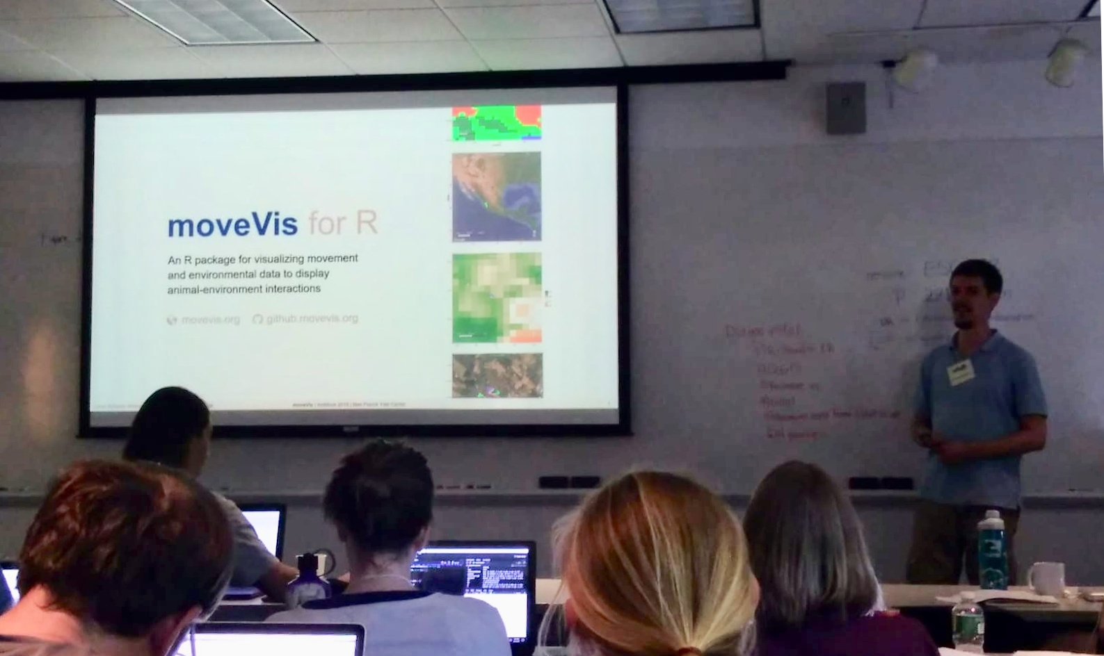
Seminar “Visualizing Animal Movement in Synchronicity with Environmental Data using moveVis”, AniMove Science School 2019, Yale University, New Haven, CT, USA.
Seminar “Introduction to Remote Sensing”, AniMove Science School 2019, Yale University, New Haven, CT, USA.
Seminar “Advanced Programming for Spatial Analysis”, EAGLE MSc., University of Würzburg
Guest Lecture “Animal Movement Tracking for Remote Sensing”, Geography BSc., University of Würzburg
2018
Seminar “Visualizing Animal Movement in Synchronicity with Environmental Data using moveVis”, AniMove Science School 2018, Max Planck Institute for Animal Behavior, Radolfzell, Germany
2017
Seminar “Visualizing Animal Movement in Synchronicity with Environmental Data using moveVis”, AniMove Science School 2017, Max Planck Institute for Animal Behavior, Radolfzell, Germany